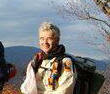
Monday, June 27, 2011

Seneca, Spruce Knob, Dolly Sods June 25&26, 2011

June 25&26, 2011
Seneca Rocks, Spruce Knob, Dolly Sods

The following picture is the classic shot of the west face of Seneca Rocks. 


We took a climbers trail that runs to the Northern Summit on the east side of Seneca Rocks because the hiking trail on the west side is closed while it is being improved this summer.    The last time I was here 25 years ago there was no hiking trail only climbers trails.      This viewing platform did not exist either.

According to this sign one of the reasons for the viewing platform is to provide a safe view that is as good as the view from the North Summit.   You can get to places on the North Summit that have great views while staying on what in my opinion is class III walking but the problem with it is that it very quickly blends into class IV and class V terrain with hundreds of feet of vertical exposure.    Not the safest place for kids or even adults without a clear understanding of the risks versus their level of skill.
Since I was not hiking solo like I normally do Anita took the opportunity to take a lot of pictures of me.
If you blow up this picture of the Gunsight Notch looking south you can see several climbing parties on the rocks.  The last time I was here the Gendarme stood like a big thumb about twenty five feet into the air right in the middle of Gunsight Notch.   The other big change was the old suspension bridge which actually used to be considered the new bridge (replacement for a truly broken down suspension bridge) has been washed away.   Changes, changes, changes.

We strolled over to the top of the under construction hikers trail and the work that appears to being done is awesome.    It appears that there is going to be three to four inches of relatively fine gravel placed on the trail.  They must be using ATV's or Bobcats to do this work.    The gravel you see in this picture was moved up hundreds of vertical feet and miles of trail.  Since it is three to four inches deep and around eight feet wide it represents tons and tons of weight.   The utility road that was here in the 70's and passes within a couple hundred feet of the North Summit still exists.   While we were getting ready to hike back to the valley a group of about 20 folks on horseback went by on the road.    I believe that while it  passes very close to the Northern Summit that it is privately owned and not on forest service land.


While the food was not as inexpensive as twenty five years ago when $5 could by you a meal the lunches pictured below including side salads and a big plate of home made bread only cost $7.
The hike did not take a huge amount of time so we took in both the new Discovery Center and spent about a half hour getting a very informative tour of an old homestead with its wonderful gardens.  The Forest Service employee offering interpretation at this house is an amazing source of information about the building, lifestyles, history and garden plants of earlier times in the area.  When last I was  here the currently restored house was nothing but a broken down ramshackle all vine covered and buried deep in the woods.   It is located over near where the old Visitor Center used to be.   

Evidently the old visitor center that I remember burnt down and the Forest Service built the Discovery Center to replace it.    The Discovery Center is several time larger than the old visitors center.    While we were there we took in an interesting interpretive displays a  movie about the history of area and enjoyed watching some locals making baskets and listening to pair of young ladies singing authentic old appalachian folk songs.  
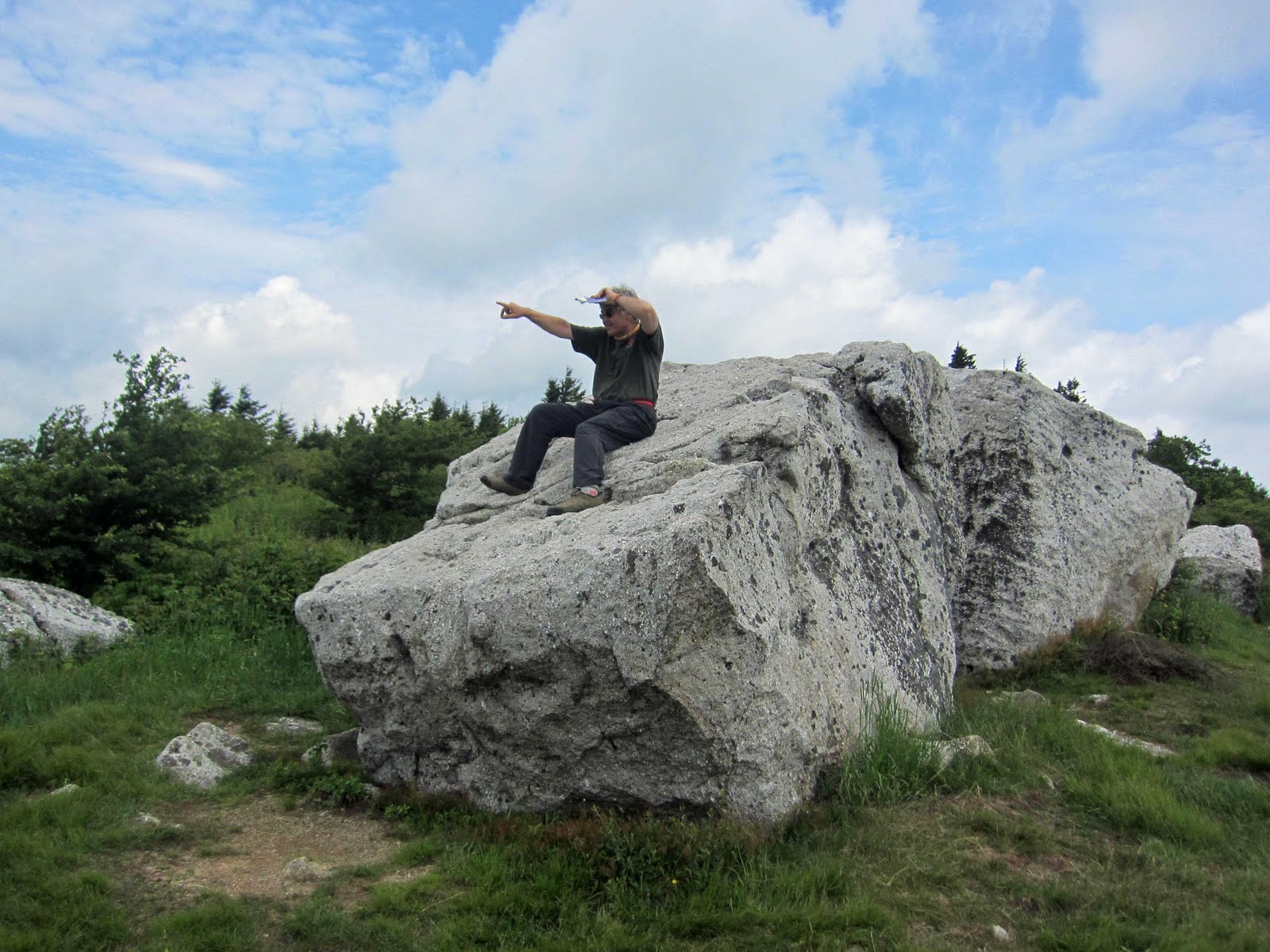
On Sunday we did several shorter circuit hikes that were all under a mile in length.   The first short hike was encompassed the summit of Spruce Knob.    We not only visited the summit platform but took a short circuit around the summit to several other view points.

This picture is actually a little out of order in that it was a roadside view point just before Spruce Knob summit.

The following picture is from within one of the Red Spruce thickets for which Spruce Knob is named.
The next two pictures were taken on a talus slope and from a bolder sitting in the middle of a high meadow.


Next stop was Spruce Knob Lake which reminded me of a twenty five acre man-made pond nestled in NY State Forest Lands a couple miles as the crow flies and eight miles by gravel roads from my parents home.    As a young kid I and friends would bushwhack on as straight a line as possible through the wilds of  the state forest for about a  couple miles in order to go fishing or hang out and skip rocks at Stony Pond.   Spruce Knob was so similar to Stony Pond I just had to take the time to skip a few rocks.  


The next stops involved a couple of one mile or less out and back hikes off of Dolly Sods fire roads.   Dolly Sods has the additional danger of having unexploded ordinance.

We walked through this huge meadow that had tons and tons of blueberry bushes.   Not ripe yet but it must be awesome eating when they are.

Hey look at all those windmills off in  the distance.   This picture was actually taken from Nature Conservancy land that adjoins Dolly Sods.

Looking back at a large part of the northern end of Dolly Sods.

Saturday, June 25, 2011

Happy Rededication For SNP

Saturday June 25, 2011
Happy 75th Rededication SNP

I had never driven the complete Skyline Drive in one continuous trip so on a partially rainy Sunday June 19, 2011 I started at the northern terminus, mile 0 and spent a good part of the  day driving to the southern terminus at mile 105.    A southbound thru-drive with  a zero-hour at the Dickey's Ridge Visitor Center.   I usually like to see the park from my hiking boots and not my car seat but it was worth doing this drive at least once.    It provided a type of gestault feel for the totality of the park and a little bit of an insight into how a vast majority of visitors experience the park.


Dickey's Ridge Visitor Center where I spent some time in the store, looking at visitor displays and watching an interpretive show in the small theatre.

The tunnel just south of Thorton Gap.

The iconic view point not far south of the tunnel.

Old Rag from a viewpoint on the drive just north of Pinnacles.    I took my time for this trip.   Ambling along in the car stopping at many viewpoints and taking the time to cruise through every picnic ground or camp ground I came to.    I think it took between 5 and 6 hours.

One of many interpretive signs along the way.

Skyland and the highest point on the drive.

An example of one of the more verbose interpretive signs.    History is never very kind to losers of wars but while crushed by the empire like north the rebels of the south seemed to often overcome impossible odds with the use of superior military skills.

Two more of the many wonderful interpretive signs.

The  southern terminus.

I thought about returning on the drive but wanted  to get home before midnight so I returned on roads that traveled up the Shenandoah River valley just to the west of the Shenandoah National Park.   

Sunday, June 19, 2011

Lavender Farm and Food Saturday June18, 2011

Lavendar Smells Like Camphor With Many Earthy Overtones and Undertones.

There are some smells that have the simple clarity of a single instrument but not freshly cut lavender,  its fragrance is like that of a symphony orchestra.  A harmonious blend of many smells. 

Originally I had a day planned with ORMS but what with my on-going program to explore different parts of the geosphere I decided that a day with my friend Anita at the Seven Oaks Lavender Farm taking a lavender wreath making class followed by a wonderful gourmet lunch at a country inn which included lavender creme brulee and lavender ice cream was in order.


Entering the lavender fields where we picked the lavender for our wreaths.
 Let the wreath making begin.
 Two wreaths complete.    One for my sister and one for the Old Rag Contact Station.
 Off we went to lunch at the Popular Springs Inn.

http://www.poplarspringsinn.com/

The following is a picture of our main entrees NY Strip and Salmon.

 AHH......the wonderful deserts.   Both the Creme Brulee and Ice Creame Puffs featured deep spicy overtones of intense and very robust lavendar flavoring.

Wednesday, June 15, 2011

Old Rag Withdrawal Advice

OLD RAG WITHDRAWAL ADVICE


If you should ever find yourself in the need to withdraw from an addiction to some adventurous sport or activity then be prepared to suddenly need to sleep all the time.  Even some cups of specially brewed extra extra strong coffee did not seem to help much.

This was in the afternoon at our Greenbrier campsite.


This was at our PATC booth in front of the Greenbrier beach.   Notice I was totally  oblivious of the Coral  snake.    For the Coral snake picture I was non-responsiveX4.    .


At least for the Rattlesnake picture some smelling salts had brought me around enough to be smiling about my new found spooning partner.

Monday, June 13, 2011

June 11&12, 2011 Leave No Trace at Greenbriar State Park Maryland


Leave No Trace e-tour at Greenbrier State Park Maryland

The Leave No Trace e-tour and Big Foot were able to help with PATC's annual picnic.    Mark and Tara arrived Friday afternoon in the Suburu pictured below.  Big Foot arrived a little later.  Their Suburu is a mobile message board and home on wheels for many months of continuous road travel.  During their journey they will be going from one venue to the next tracing a big figure eight on the map of the USA.   With a focus on youth outreach they will be providing hundreds of Leave No Trace outreach/education sessions almost right up through the end of 2011.

They have a blog which allows you to follow their travels check it out:


What is the Leave No Trace e- tour?:

The Leave No Trace e-tour overview page which has lots of information and can be found at the following link:


On this page you can find the following:

What is the Leave No Trace e-tour?


The Leave No Trace e-tour, sponsored by the Coleman Company and The North Face, brings hands-on Leave No Trace demonstrations, interactive activities and general Leave No Trace education to schools, camps and youth-serving organizations from May through August. The team also travels to select retailers specializing in Coleman outdoor products in order to promote Leave No Trace information to kids and families. The e-tour provides basic Leave No Trace education programs that inspire youth to get outside while promoting responsible enjoyment of the outdoors.


Big Foot finally caught up to the Leave No Trace e-tour team at Maryland's Greenbrier State Park.
PATC,  PATC Trail Patrol,  Emergency Response Training, LLC, and Leave No Trace e-tour pop up tents were set up on the Greenbrier beach providing information, outreach, and education until the PATC picnic  got started with all its great food.

PATC Trail Patrol had the honor of hosting Big Foot and the 2011 Leave No Trace e-tour team of Mark Ardagna and Tara McCarthy.   The next picture shows the hosts and Big Foot clustered around an Appalachian Trail(AT) interpretive sign outside Greenbrier's Visitor Center.    The AT passes through the park and it is a relatively easy hike from the park to Annapolis Rocks.   The PATC Mountaineering section offered folks a chance to do some top roping.


Besides Saturday's outreach the Leave No Trace e-tour team provided a wonderful multi-media presentation for all park visitors in the park's amphitheater on Friday night.     I did not get to talk much to Big Foot over the weekend but I got the sense that he struggles a little with his huge passion for spreading the Leave No Trace word and his natural shyness.  Big Foot's natural habitat usually involves colder temperatures and perhaps even snow.   I believe it was the Greenbrier Visitor's Center's air conditioning and ice cream social that helped over come Big Foot's shyness such that he decided to visit with some delighted children.    Ice Creme, Big Foot and really cool interpretive wildlife displays at the interpretive center a formula for fun and a little learning. 

Right after the ice creme social Randy and Georgia Motz (trail names Windtalker and Mom) provided a short flute recital and a multi-media presentation about their 2006 AT Thru-hike. Award winning authors of two books, "Solemates - Lessons on Life, Love & Marriage from the Appalachian Trail" and "The Walk - Reflections on Life &; Faith from the Appalachian Trail" they are members of PATC and have a passion for communicating about their AT experience. For more details about them and their presentation the following link takes you to the press release for the Greenbrier presentation:


http://www.free-press-release.com/news-award-winning-authors-to-speak-about-hiking-the-appalachian-trail-at-greenbrier-state-park-as-part-of-potomac-appalachian-trail-club-day-festivi-1307462565.htm


Home sweet home for Friday and Saturday nights.


Of course on Sunday afternoon the whole crew was off without leaving a trace we had been there.

One of those great weekends spent with great folks who share a  passion for wild places and outdoor adventure.    

Monday, June 6, 2011

Helicopter Evacuation Skyline AKA PATC Wall

HELICOPTER RESCUE VIDEOS
Sunday June 5, 2011
Fifty (50) Foot Grounder
Climber On Skyline AKA PATC Wall

Fairly late on Sunday afternoon ORMS staff was getting ready to start some scenario training when a call came into the park that a 50 plus year old climber had taken a fifty foot fall on Skyline AKA PATC wall.    Once again our planed for scenario training was replaced with a real response.   

A fifty foot grounder is a very serious fall which can produce relatively instant death.  I am told by a medical professional friend that the LD50(point where statistically 50% die) is a fall from 48 feet.  Even if the patient does not die from the immediate impact injuries that can result from the fall will be substantial.   There will be a high probability that the patient will be in for a serious fight for life.   Rapid delivery to modern medical facilities with top notch emergency trauma and surgical teams may make the difference between the patient's living and dieing.   

It was very fortunate for this patient that  ORMS had highly trained responders high on the mountain and that the weather conditions were such that they were not stressing the patient.  Most importantly the weather and time of day meant that  a National Park helicopter could respond and rapidly evacuate the patient to a modern hospital.

Based on the comment provided by the patient's wife he has survived and is on the path to recovery.    

Our hopes and prayers go out to the patient and all the follow-on medical personal that will be involved with the efforts to restore the patient to hopefully full health.

Events Leading To Fall
There were some initial reports but like many initial reports they probably have some inaccuracies.    Suffice it to say that a very experienced climber somehow thought they were on a secure line that was not secure.   When they went to put their weight on the line they fell fifty feet to the ground.    Please see the 9th comment below supplied by one of the patient's friends.


REMINDER TO ALL OLD RAG VISITORS
While Old Rag is within an easy day trip's driving distance from a lot of metropolitan areas,  it is not a city or suburban park!   It is back country!   Cell phone's generally only have service high on the Ridge.     The fastest means of requesting emergency help may be to send a runner out to the trail head.     Emergency Response teams will need to drive tens of minutes to trail heads and then spend 10s of minutes if not hours hiking themselves and equipment to the patient.     

On this day the patient was lucky both that ORMS had trained responders high on the mountain and one of the park's helicopter Eagle (one or two?) was available to respond.   Considering the location of the accident an incredibly fast extraction was accomplished and the patient was on their way to a hospital via helicopter not to many hours after his accident.  

Visitors to Old Rag should understand and act with the knowledge that there is a very high probability that the stars, planets and moon will not be as aligned as they were for this patient.     In the event of a serious accident or onset of a serious medical condition most patients will be facing two to three hours wait before the first help will reach them.   Placement in an ambulance for transport to a hospital may take an additional five to ten hours.     From time a non-ambulatory accident occurs on Old Rag until the patient arrives at the hospital it can take up to fifteen hours.   


Sorry about the quality of the following videos.

WOW GREAT VIDEOS FROM
Dan Nichols one of the
Good Samaritans That Helped

The following two links have video footage supplied by Dan Nichols that is way better than mine.
See Dan's comments to this post.    He his friends and others mounted initial good Samaritan efforts before ORMS resources arrived.

Dan, huge thanks to you and your friends for all the response help and for sharing these great videos.

BRAVO ZULU

http://www.youtube.com/watch?v=aE_kfuxfWkg

http://www.youtube.com/watch?v=uCHWcy_wPts

This first video is just a shot of some helicopter lift equipment being delivered to the ground personnel.   Not very exiting unless you are a responder looking at it for training purposes.   Best to just watch the second video.

http://www.youtube.com/user/robertlook1?feature=mhee#p/a/u/1/odsSk942m_A

The second video shows the patient being lifted with tag lines being manned by ground personnel.


http://www.youtube.com/user/robertlook1?feature=mhee#p/a/u/1/SkHFHkANl_E

THANKS TO ALL THAT HELP
The next pictures show some of the end of incident activities.    Even when it is felt that a successful helicopter extraction has a high probability the Incident Commanders will generally  rally resources assuming the helicopter extraction will not succeed.    With hiking times measured in hours they can not wait for one option to fail before initiating preparations for the contingencies.     Thankfully the contingency plans did not need to be exercised.     That said, right around the time the helicopter got the patient airborne,  teams of park employees were arriving on Skyline Wall with hundreds and hundreds of pounds of equipment.   Had the helicopter  extraction failed the response team was prepared for  a rapid and smooth transition to a long manual carryout.     

The next three pictures show many of the tens of folks who were directly involved in the robust flexible response for this patient.  

Good Samaritans   
Some with formal training for emergency response and some without.  Like Border Collies who just have an intense desire to help with the flock there are some who respond because it is in their genetics and they can not abide not to if they see someone in need.  
Note: While not exactly the same the SheepDog reference is an improve off of a concept of Sheep Dogs first espoused by an old retired Vietnam era Colonel and used by William J. Bennett - in a lecture to the United States Naval Academy November 24, 1997 and also used by author LTC (RET) Dave Grossman and also by video self help Internet author NutNFancy.

Both behind and before any response like this there are hundreds of man hours spent planning and preparing to make sure that the equipment and highly trained human resources will be available when needed.


  • Park management has to obtain budgets for equipment, training, and response pay.
  • Government and volunteer organizations prepare and train, prepare and train, then prepare and train some more.  
  • Other government and non-government organizations donate equipment.         
  • Not too be forgotten,  families and friends selflessly give up anticipated plans when their loved ones participate in these often long and arduous responses.


National Trails Day