Showing posts with label Blaze Number. Show all posts

Monday, November 19, 2012

November 17, 2012 Cool Crisp Clear Day


 November 17, 2012 Cool Crisp Clear Day


Ice is beginning to form.  It is easy to walk around it now but it is a harbinger that sometime this winter ice traction assistance will be required.   Best to at least put them in the car and sometimes carry them up the mountain if your in doubt as to whether they will be needed.
 

BLAZE NUMBERS
Periodically there are numbers on the blue trail blazes.  The reason they are there is so that the Park's backcountry emergency responders will know what resources they need to bring in order to effectively help a hiker in trouble.    Cell phone service will sometimes work high on the Ridge Trail.   It will be tremendously helpful to the dispatcher if you can tell them where you are located compared to a blue blaze number.    Besides the mechanism of injury, the nature of the injury, the weight of the patient will be important.    There is an emergency phone on the outside of the Ranger Contact Station in the Old Rag Parking lot.
Some of my favorite times on Old Rag are just after sunset but you need to very comfortable hiking under a headlamp if you are going to be high on the mountain after sunset which comes very early in the day for the next few months.


Wednesday, May 30, 2012

Sat Sun Mon Memorial Day May 26,27,28, 2012


MEMORIAL DAY WEEKEND

A REVERENT THANKS TO ALL WHO SACRIFICED

FOR OUR WAY OF LIFE


WHAT DO THE BLAZE NUMBERS MEAN?

The numbers are there to help the park know how to quickly find you, the number and skills needed of incident response team members, as well as what types of equipment will be needed in the event a hiker has an injury.   If you need to report a hiker who needs help it is very helpful if you are prepared to let the park know the nearest R (for Ridge Trail) or S (for Saddle Trail) number and how far above or below the hiker is from the marker.  The are not even close to being evenly distributed.    On open trails they can be thousands of feet apart and then their are places in  the rock scramble where they can be only 100 to 200 feet apart.   


After all our rain the plants were looking really healthy.

The Mountain Laurel blossoms were still very pretty but you could start to see signs that it will soon be gone for 2012.


WE ARE DOING BAD WITH TRASH FOLKS

I am not sure why but the cold weather hikers are much better about both not trashing the mountain up and also about picking up and taking out trash that is not theirs.

Once the warm weather arrives things seem to go from almost pristine to sometimes looking like a garbage dump in places!    By the way folks just because you throw something off a high cliff it does not mean it will not be seen.   Climbers and other backcountry visitors will see your trash sooner or later.  If you pack it in pack it out.   If you have some room and feel like a good samaritan take some trash out that is not yours.   Be polite and respectful but spread the word.

LEAVE NO TRACE! 

Of late I have had numerous hikers complain to me that the mountain is becoming disgusting to hike becasue of all the trash along the trail.  Folks nobody likes to see your old Orange peels, toilet paper, water bottles, egg shells, nut shells, power bar wrappers or anything else.   Whether you are a new hiker or old experienced pro please make sure you learn appropriate outdoor ethics and practice them.

Leave No Trace Link:  http://lnt.org/

Looking back on the First False Summit from near the cave.


A large Mt Laurel in bloom on the summit.


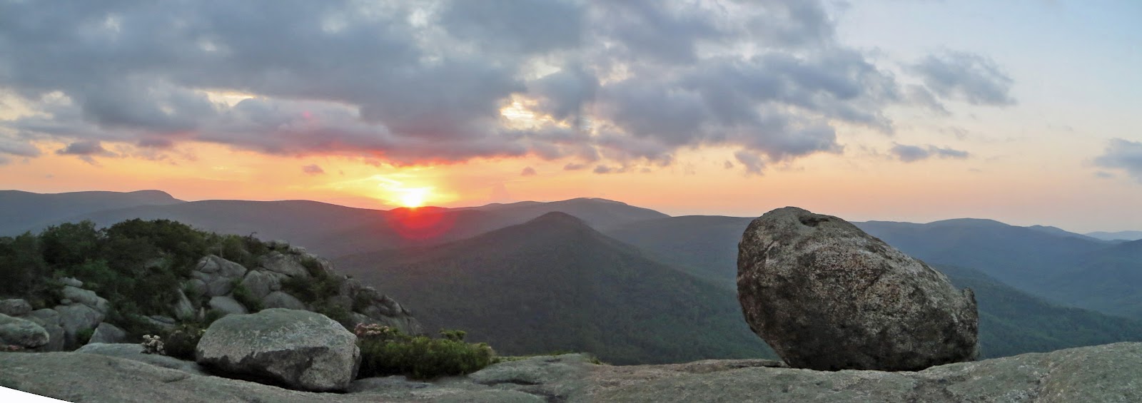
SUNSET


Another great sunset from the summit.   Make sure you have a good headlamp and a backup headlamp if you are going to hiking in the dark.


VENEMOUS COPPERHEADS AND RATTLESHAKES

ENJOY THEIR NATURAL WONDER BUT BE CAREFULL!

I almost never see Copperheads during the day but I see them on or next to the trail a lot during the night.   They are nothing to worry about as long as you do not step on or near them.  Please make sure you have a good light and that you never place your hands or feet near or under anything that you have not visually checked to make sure there is not a venomous snake that might fear bite.

On my walk out in the dark I saw two Copperheads of almost exactly equal size just 200 feet apart on the road to the parking lot.   The first one scurried off into the grass before I could get my camera out but I did get these two shots of the second one.    If you keep your distance they are a wonderful part of nature to be lucky enough to come across.    Please do not disturb or hurt them.    They keep the rodent population down which in turn helps keeps the infectious tick population down.

Tuesday, August 23, 2011

Sunday August 21, 2011 Smoke, Friends, Sunset, Wedding


Sunday August 21, 2011
Bouldering, Sunset, Day After The Wedding

Remember clicking on pictures gives more resolution.

With the rain and warm weather the fungus are doing well.
Ben one of the lead ORMS Stewards was on a personal hike/bouldering day with a climbing friend.    I saw ORMSer Craig T.  with a friend also doing a personal hike earlier in the day.
I think that lots of folks have a soft spot in  their heart for this gentle S turn in the trail so this picture is for them.

Campers with an illegal campfire down in Weakley Hollow.    Taken from just below Atlas Rock looking towards the upper parking lot. 

HEY FOLKS FIRES ARE GENERALLY NOT ALLOWED IN SNP.    THERE ARE SOME EXCEPTIONS TO THIS RULE.  PLEASE CHECK WITH A RANGER OR PARK ELECTRONIC OR HARDCOPY PUBLICATIONS IN ORDER TO CLEARLY UNDERSTAND THE RULES.    MAKE SURE YOU ARE READING A CURRENT PUBLICATIONS BECAUSE THINGS CAN CHANGE WITH TIME.   IF FOLKS CAN NOT OBEY THE RULES WE MAY LOSE THE RIGHT TO HAVE ANY FIRES ANYWHERE!

Below is a picture of a Blaze Number the R stands for Ridge Trail and the S's stand for Saddle Trail.   The numbers have nothing to do with distances.  They have meaning to search and rescue folks so if you are calling in an emergency it would be good to be able to tell the emergency response folks where you are in relation to the closest blaze numbers.   Based on that information the SAR folks will know what types of equipment and human resources will need to be called out and sent up the mountain in response to your emergency.


RACCOON FRIEND ACT IV
(ACT V IF you count the report from my ORMS friend after he and his son's scout troop had an encounter with the raccoon being out on the summit begging for food on the one weekend I did not see her myself.)

I saw my  raccoon friend on the ledge that over looks the first false summit just above the Chute.    I said HI and started to get my camera out when she scooted off out of sight.   Boy you would think she was a public figure and I was the paparazzi.   Although I am glad that she looked very healthy and seems to be getting shy of humans.


ANOTHER WONDERFUL SUNSET EVOLVED THROUGH THE EARLY EVENING HOURS.

SPIRITUAL MAGIC!
THANKS!


Saturday, July 4, 2009

Friday July 3, 2009 Old Rag Summer

Friday, July 3, 2009

Cool partly cloudy early summer day. Only 62 degrees on the summit at 8PM. I was patrolling for PATC Trail Patrol today. Fairly large turn out for the hike today. The lower lot was about seven eigths full. Lots of information provided but no medical or search incidents. I spent a lot of time working on my list of the Blaze numbers and did a small bushwack to check on some smoke that had been seen from the fee station.

I have come to greatly enjoy the walk from the lower lot to the upper lot. The following pictures of flowers and wineberries are all taken along the road to the upper lot.


Groups that park in the upper lot miss some good parts of the hike.
PARKING PROBLEMS THE TIMES THEY ARE A CHANGING
People get so fixated on being able to score a parking place in the upper lot they often park illegally along the road. Snagging one of these coveted spaces makes some visitors as crazy as a buck during rut.
.
Imagine the upper lot is your drive way at the end of the cul-de-sac. Your neighbors understood when at the time of your kid's wedding, graduation party, or when you hosted Thanksgiving that you had fifteen cars parked on the road. But when you started hosting a hugely popular yard sale every weekend and some customers were so rude as to leave tire ruts on your neighbors lawns something had to change.
.
Back to reality, the land right up to the very edge of the upper lot is private land on both sides of the road. Cars are not allowed to park on the pavement and land owners are tired of people parking on their land. Signs, baricades, cones, park traffic enforcement vehicles and park law enforcement officers have not succeeded in the face of some hikers' overpowering need to score an upper lot space.
.
After an irritating problem exists for a long time you sometimes learn to just live with it until a tipping point is reached. My sense is that we are at a tipping point. I have no clue what the cascade of events will be but it feels like a thunderstorm of changes are brewing.
.
Some day you may be able to brag to your grandson about how in the old days you would wake up extra early so you could limo half way up the mountain.

BLUE BLAZES WITH NUMBERS

The blue blazes with numbers in them have meaning to the 24X7 communications center for Shenandoah National Park. If you need to phone an emergency in it would be good if you know what the closest blaze with a number on it is. Other than their use for emergency response these blazes have no other known use.
.
If you can not find a blaze with a number than any other way to concisely and accurately describe the injured parties location is the next best thing. If you are reporting a missing party it would be good to be prepared to provide descriptions, last point the party was seen and their direction of travel, and any other pertinet information.


The following are some early evening shots among the boulders on the Ridge Trail. Nice clouds on this evening.


Sunday, February 22, 2009

Sunday, February 22, 2009 Old Rag Signs

Old Rag Bear Sign/Scratching Post

http://www.bear.org/website/


Old Rag Fee Station Signs About Self Registration and No Pets

The No Pets sign is only applicable to the Old Rag Trails the other trails and fire roads that are accessed from this Nethers/Old Rag parking lot allow pets on a lead. The park service has a web-site page http://www.nps.gov/shen/planyourvisit/pets.htm which details which trails do not allow pets. The vast majority of trails allow pets. The Ridge Trail has places where a dog would need to be lifted up or down the rocks. Local lore has it that some years ago a very small dog was attacked and carried off the summit rocks by a large bird.

Old Rag Trail Blaze With Number R3
Note 1: Some Ridge Trail blazes have R#s and some Saddle Trail Blazes have S#s.
Note 2: If you have to report an accident knowing the victims location relative to a nearby numbered blaze will help the responders know how to best respond.